OK, so I’m not in Peru but I’m in Melbourne sitting in front of my computer (actually, had our trip gone ahead, we would still have been in Santiago).
So where shall I go today?
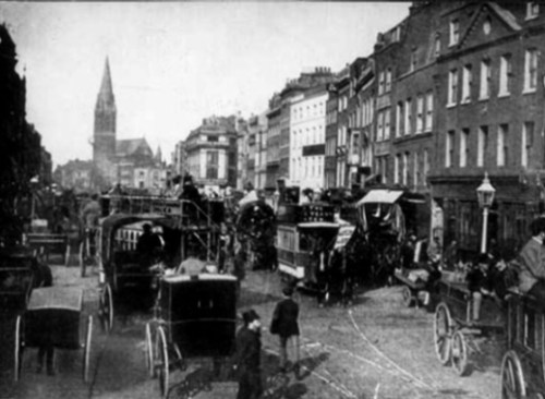
Whitechapel High Street 1905 Source: Wikimedia
How about the East End of London? in particular, the Jewish section. The Memory Map of the Jewish East End is a fantastic digital resource that takes you to Whitechapel and Spitalfields which had a strong Jewish presence from the 1700s onwards, but particularly in the first half of the 20th century. This site has two views: the first uses the Ordnance Survey of 1913, and the other view is the most recent Ordnance Survey, where the lanes and small streets have been swallowed up by larger buildings. There are four themes: education, community, business and religion. When you click on the coloured features, up pops a modern picture of what is there now then if you select ‘read more’ you can see pictures from the past, some explanatory text and some oral history excerpts.
Hours of fun! https://jewisheastendmemorymap.org/
And here is one of the creators of the site, Rachel Lichtenstein writing about it: http://www.historyworkshop.org.uk/the-memory-map-of-the-jewish-east-end/

I think we read about this in Robyn Annear’s new book… about secondhand cloth trade?
That’s right. But there were streets and lanes devoted to other trades as well, e.g. the jewellery trade.
We should have been heading off west today to do a lap. Had not thought about a Cook’s Tour of the UK the UK. Might just settle back and enjoy the trip.